August 8, 2014
Source: CGIAR Blog
A recent workshop built capacity to use new climate information tools in West Africa. Agricultural practitioners are seeking to build resilience to climate variability and change while maximizing the benefits from favorable climate conditions.
Decision-relevant climate information at different levels is critical to this ability, and involving users in the creation of climate information products can ensure their relevance to specific decisions or set of decisions.
Climate information is a vital input
Climate risk management in agriculture and other sectors requires mainstreaming climate issues into development policy, planning, and practice at different decision making levels. Easily accessible quality-assured information on the past, current and possible future climate at different levels is a vital input. Such information could be used to support early warning systems that alert decision-makers to potential food insecurity.
Climate information could also be used to better map populations and systems where climate poses a risk and thus improve long term planning. Historical data could improve the routine rainfall monitoring products currently used for farmer focused weather-based index insurance for example, as well as the accuracy of seasonal and longer-term climate forecasts and predictions.
There is no climate information without climate data
Climate data is the foundation for climate information and services. Good climate information and services depend on quality climate data. However, the availability of climate information is very limited in some areas. The number of weather stations, particularly in Africa, is insufficient and has been declining. The distribution of existing stations is also uneven, with most stations located in cities and towns along major roads. Thus, lack of coverage tends to be worse in rural areas where livelihoods are the most vulnerable to climate variability. Where station records exist, data quality and access is often lacking and records can suffer from gaps in space and time.
The Enhancing National Climate Services (ENACTS) solution
The International Research Institute for Climate and Society (IRI), and the CGIAR Research Program on Climate Change, Agriculture and Food Security (CCAFS) in collaboration with National Meteorological Agencies and Regional Climate Centers, has been leading an effort to simultaneously improve the availability, access and use of climate information at national and regional levels.
The ENACTS initiative focuses on the creation of reliable climate information that is suitable for national and local decision-making. Data availability is improved by blending national observations with satellite and other proxies. This approach has been used to generate over 30-years of rainfall and temperature data for every 4km grid. Access to information products is improved by providing online tools for data analysis, visualization and download. These online tools are integrated into the National Meteorological Services’ web pages. The use of the information products is facilitated by training users and using user feedbacks to improve the information products.
ENACTS has so far been implemented in Ethiopia, Madagascar, Rwanda, Tanzania and the Gambia at national levels, and at the regional level for the CILSS countries (Burkina Faso, Cape Verde, Gambia, Guinea-Bissau, Mali, Mauritania, Niger, Senegal and Chad).
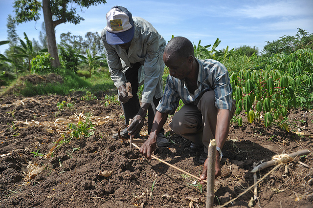
DEVELOPING CLIMATE INFORMATION TOOLS FOR AGRICULTURE INVOLVES ONGOING INTERACTION WITH USERS. PHOTO: K. TRAUTMANN.
User input is critical to go beyond generic climate information
The ENACTS online web interface currently includes three Map Rooms for Climate Analysis, Climate Monitoring, and Climate Forecasting. These three maprooms are generic in that they do not target any specific application. Thus, the IRI plans to develop sector-specific maprooms targeting the agriculture and food security, water and health communities. However, it would be impossible to develop these sector-specific tools without the participation of the intended users. This requires constant dialogue and interaction with the user groups.
This was the main objective of the workshop organized by the AGRHYMET Center (in Niamey, Niger) in collaboration with IRI, CCAFS, the United States Agency for International Development (USAID) and the United Nations Development Program (UNDP). The workshop was convened to critically engage stakeholders on the value and application of climate information products. Recognizing the need for constant dialogue and interactions with different user groups, this workshop identified practitioners in the agriculture, water and disaster risk management communities to work towards improved climate resilience in West Africa.
The workshop provided a platform for stakeholders to share their feedback on the value of the new information products and tools for their activities and on recommendations for what is still needed. These recommendations are very valuable for improving the information products and developing new tools targeting specific applications.
The three-day meeting in Niamey, Niger January 21-23, 2014 was attended by a total of 40 participants and facilitators.
Check out the workshop report.
Co-generation of climate information products is an iterative process
Improving the use of climate information products is an iterative process, and the workshop was a first step. As the process stands, AGRHYMET and IRI will implement the recommendations from users. A second workshop will be convened in which the improvements and new additions to the information products will be presented and discussed. This will enable participants to learn about the new products and to offer additional feedback. Then AGRHYMET and IRI will work to implement these new recommendations and then go back to the users again. The idea is to generate the most useful information through multiple iterations.